For building owners and developers, poor phone coverage translates directly into tenant dissatisfaction, weaker lease negotiations, and ongoing complaints that erode the perception of a quality asset. For tenants, mobile connectivity is a baseline expectation. Nobody thinks about checking signal strength during a building tour, but everyone notices when their phone stops working on level three. For construction contractors, an early understanding of coverage requirements means cable pathways, riser space, and comms room capacity can be factored into the build from day one rather than retrofitted at someone else's expense later.
The cheapest and most effective time to address mobile coverage is during the design phase, before a single slab is poured. And the first step in understanding whether your planned building will have a coverage problem is analysis.
Running a Coverage Analysis with the Building Estimator
Axidra's Building Estimator is a free online tool that lets you model a planned building and run a mobile coverage simulation against it. It's designed to give property owners, developers, and project teams a first-pass understanding of signal conditions before engaging anyone for a formal consultation.
The tool is available at axidra.com.au/building-estimator. Start by entering the address or coordinates of your site. The estimator will load high-resolution building models for the property boundary, giving you a satellite-based view of what currently exists on the land.
For a greenfield scenario, whether that's vacant land or a site where existing structures will be demolished, the next step is to modify or replace those building models with your planned footprint. Opening the Polygon Editor lets you add, edit, or delete vertices on the existing building outlines using a familiar point-and-click interface.
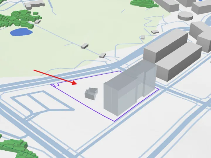
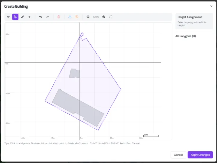
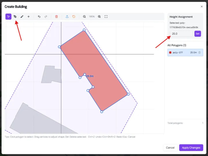
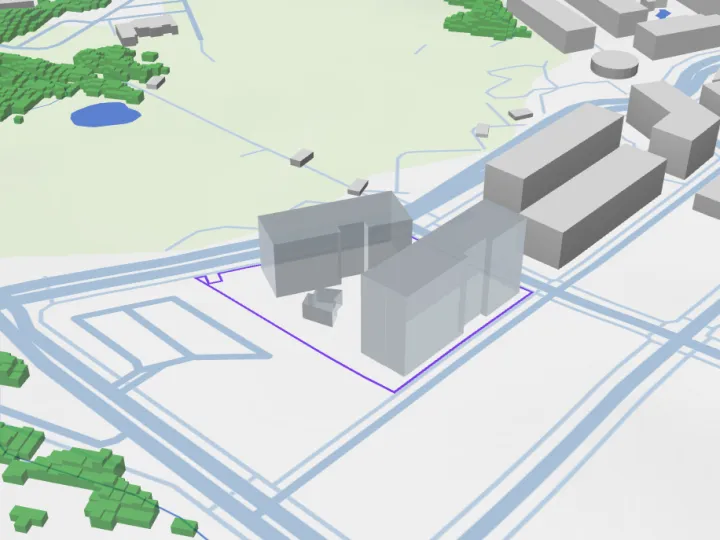
If you already have your building footprints in digital form, you can delete the existing polygons and upload your own. The tool accepts industry-standard GeoJSON format, and supports an extrusion height column (named "Height") to represent the building in 3D. If your GeoJSON doesn't include height data, you can assign a value in metres manually.
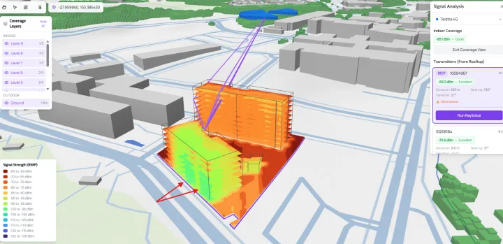
Once you save your edits, the building appears as a 3D model on the map. Select the building and click Analyse Signal to submit it to the RF analysis engine. The tool runs a propagation simulation against the surrounding cell tower network for the mobile operator you've selected (all transmitters in range), and returns a visual coverage map overlaid on your building footprint. For multi-storey buildings, coverage maps are generated for each floor, giving you a three-dimensional picture of where signal is strong, marginal, or absent.
The simulation is conducted using industry-standard ITU scientific models, ensuring the analysis is defensible and as accurate as reasonably possible under the obvious limitations.
Nothing is stored permanently. The analysis is yours to review, screenshot, or share with your project team, and the modified building models are discarded after the session unless you submit through for estimation.
Submitting for Estimation
If the online analysis has indicated a potential signal issue, you can obtain a quick price estimate for a coverage solution. Simply click on the building of interest, press Configure to set your requirements, and then Add to Estimate.
A sidebar will pop out showing you a typical price range based on the building's shape, height, location, and coverage needs. You can add additional buildings as needed. One thing to note is the tool will separate a building into its major shapes, so a smaller wing will show as separate to the main central structure.
Once you're happy, open the side bar (if it's closed press the $ symbol in the tools menu), hit Submit for Estimation. You'll be redirected to the Axidra Cloud portal where you can view your submission, add details (upload floor plans, pictures, notes) for our engineering team to review. The team will reach out to discuss your project further to help narrow down an accurate price.
What the Estimator Can and Can't Tell You
The Building Estimator is a planning tool, not a substitute for a professional RF design. Because it doesn't know about your building's internal layout, wall materials, or partition placement, it uses a simplified attenuation model based on the building envelope. This gives you a reliable indication of whether the external signal environment is favourable or problematic, and whether coverage gaps are likely based on the building's geometry, but it won't predict the exact signal strength in a specific room on a specific floor.
Basement-level coverage also falls outside the scope of the estimator. Below-grade analysis requires detailed modelling of the structure above and entry points for signal (ramps, elevator shafts, stairwells), which we need to look in more detail.
Think of it as a screening tool. If the estimator shows strong coverage across all floors, you're probably in a good position. If it shows marginal or weak coverage, that's a clear signal to engage early and factor an IBC system into the build programme rather than discovering the problem after handover.
For a detailed assessment that accounts for internal layouts, material specifications, and multi-operator requirements, Axidra offers a Consultancy Service where we model the building in full 3D, including internal walls and basement areas, using our proprietary RF analysis platform.